My interest in cartography was born out of a childhood of Tolkien and RPG maps and only deepened by my study of the Golden Age of Cartography. My map of the Kansas City area’s SCA chapters was drawn to better understand the compositional elements of the great sixteenth century mapmakers. It was so well received that it was awarded the Judges’ Choice at the Calontir 2017 Tri-Levels arts & sciences competition.
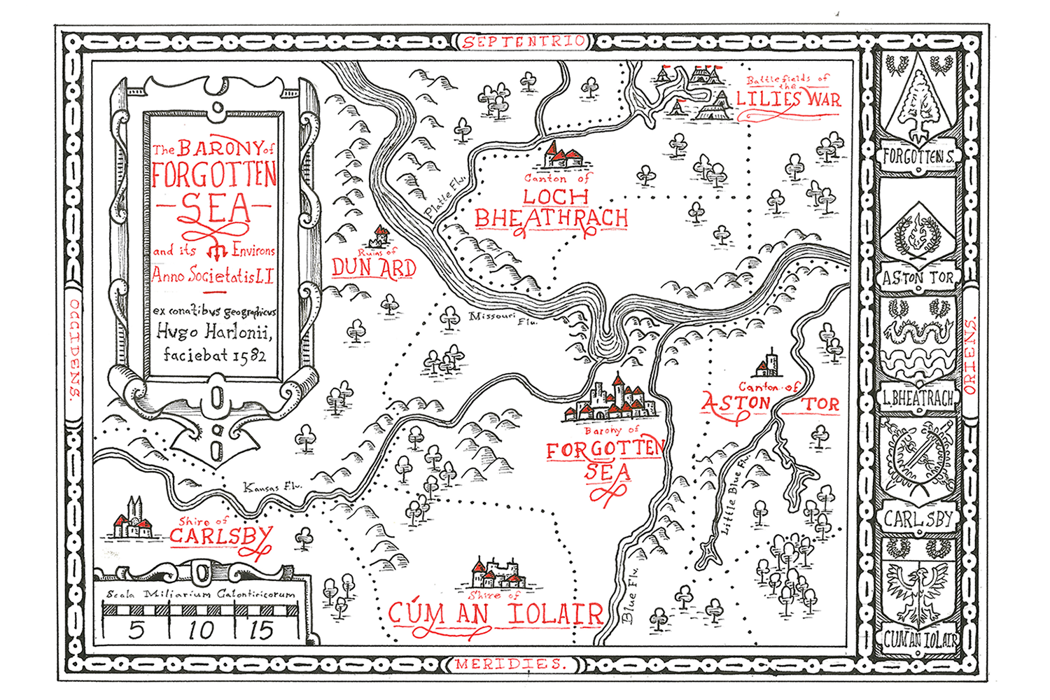
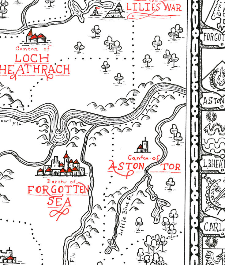
Scan of the completed map, 14×10″ on hot press watercolor paper
Project Abstract
This is a map in the style of late sixteenth through early seventeenth century cartographers from western Europe such as Sebastian Münster, Geradus Mercator, Fernão Vaz Dourado, John Speed, John Norden, and those mapmakers commissioned by Abraham Ortellius.
As a result of my research, I argue that the similar artistic conventions seen in the layouts, embellishments, typography, and geometric Mannerist ornamentation found in maps of this period represent a historical unity and continuity. This is why I am confident including cartographers who are slightly Out of Period as a reference.
The work as entered represents the initial step in the printmaking process: the creation of the map itself with ink before the intaglio printing process began. The use of red ink, however, is a deliberate stylistic deviation to improve the aesthetics of the piece and pay homage to Münster and Dourado’s careful use of red in their own compositions.
View Accompanying Project Documentation for the Map of Forgotten Sea (PDF)
Works Cited
The references consulted for this project were a mix of scanned and/or published facsimiles of extant maps of the period, historical surveys on the role of cartography during this period, and art reference books to better emulate the Mannerist ornamentation prevalent on the maps of the era.
AICL Colóquios da Lusofonia. “Atlas De Fernao Vaz Dourado”. AICL Colóquios da Lusofonia. N.p., 2017. Web. 12 Apr. 2017.
“Atlas Sive Cosmographicae Meditationes De Fabrica Mvndi Et Fabricati Figvra.Dvisbvrgi Clivorvm [1595]”. The Library of Congress. N.p., 2017. Web. 12 Apr. 2017.
Binding, Paul. Imagined Corners. 1st ed. London: Rewiew, 2003. Print.
Buisseret, David. The Mapmaker’s Quest: Depicting New Worlds In Renaissance Europe. 1st ed. Oxford University Press, 2003. Print.
Buisseret, David. Monarchs, Ministers, And Maps. 1st ed. Chicago, IL [etc.]: University of Chicago Press, 1992. Print.
Butsch, Albert Fidelis, and Alfred Werner. Handbook Of Renaissance Ornament; 1290 Designs From Decorated Books. 1st ed. New York: Dover Publications, 1969. Print.
Crane, Nicholas. Mercator. 1st ed. New York: Henry Holt and Company, 2014. Print.
Hessler, John W. The Naming Of America. 1st ed. London: Giles, 2008. Print.
“Theatrum Orbis Terrarum.”. The Library of Congress. N.p., 2017. Web. 12 Apr. 2017.
Van Duzer, Chet. Sea Monsters On Medieval And Renaissance Maps. 1st ed. Print.